Trails, permits, fees and bus routes checked July 2026.
Tenerife is one of Europe's best year-round hiking islands, built around three very different massifs: the laurel forest of Anaga, the volcanic summit zone of Teide, and the deep gorges of Teno. The complication is the 2026 permit and fee system, which now covers the Teide summit, the Masca gorge and Barranco del Infierno.
This guide compares every flagship trail by difficulty, length, permit status and whether you can reach it without a car. Eight of the ten walk from a bus stop. It suits both first-timers picking one hike and returning walkers planning a full week. Trails, permits and bus routes checked July 2026.
Hike finder
Find your perfect Tenerife hike
Answer a few questions and we'll match you to the right trail from the ten below — with a transparent score, so you can see exactly why. It updates live as you choose.
Chamorga → Faro de Anaga
Perfect match
Match
A laurel-forest village walk down to a working lighthouse, with sea views the forest trails miss.
Why we picked this
- Easy–moderate — matches your level
- Fits your time window
- Direct bus (947)
- No permit needed
- Forest, Coast, Viewpoint
Also worth it
- Santiago del Teide → Masca ridge90% · Moderate
- Chinyero Loop (PR-TF 43)81% · Easy
- El Pijaral (Bosque Encantado)77% · Moderate
At a glance
Every major trail compared
Here is every flagship trail on one screen, so you can match difficulty, permit and bus access before you commit to a single boot.
| Trail | Zone | Difficulty | Length / time | Car-free (TITSA) | Permit / fee (2026) |
|---|---|---|---|---|---|
| El Pijaral (Bosque Encantado) | Anaga | Moderate | 6.7 km circular / 3–4 h | Line 945, then taxi or walk to La Ensillada | Free permit via Tenerife ON, 45/day, €600 fine without |
| Chamorga → Faro de Anaga | Anaga | Easy–moderate | 9 km circular / 4 h | Line 947, direct | None (Anaga free-access runs to 31 Dec 2026) |
| Afur → Taganana → Afur | Anaga | Hard | 14.3 km circular / 6–7 h | Lines 945/947 to Taganana | None |
| Telesforo Bravo (PNT-10, summit) | Teide | Very hard | 0.6 km one-way / 40 min | Lines 342/348, then cable car | €15 non-resident, €6 other-Canary, ID checks, €600 fine |
| Montaña Blanca (PNT-07) | Teide | Very hard | 8.3 km one-way / 4–5 h | Lines 342/348 to trailhead | €6 weekday / €10 weekend, non-resident |
| Chinyero Loop (PR-TF 43) | West / Corona Forestal | Easy | 6.4 km circular / 2–3 h | Limited: 325/460/461/462 to Santiago del Teide, then walk | None |
| Masca Gorge | Teno | Hard | 5 km one-way descent / 2–4 h | Line 355 shuttle, mandatory | €40.66 adult / €20.33 child, plus mandatory boat exit |
| Camino del Risco → Punta de Teno | Teno | Hard | 10.1 km point-to-point / 4 h | Line 369 from Buenavista (cars banned) | None for the trail |
| Santiago del Teide → Masca ridge | Teno | Moderate | 9.2 km point-to-point / 4 h | Line 355 for the return | None |
| Barranco del Infierno | South (Adeje) | Moderate | 6.5 km round-trip / 3.5 h | No trailhead bus, Adeje town plus uphill walk | €15 non-resident, 300/day cap, helmet required |
Two columns do the heavy lifting here: car-free access and the permit reality. Read those before you fall for a trail you can neither reach nor legally enter.
Anaga
Hiking in Anaga
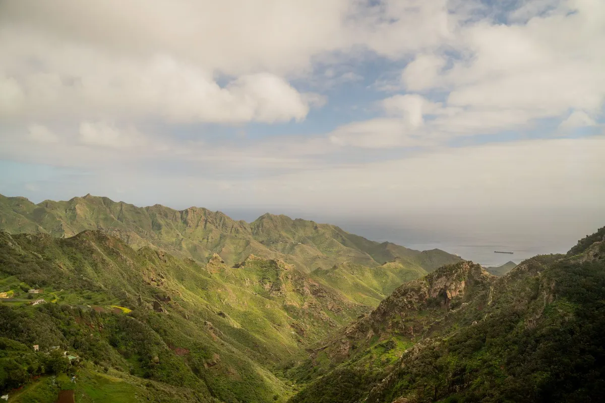
Anaga is the oldest part of the island and the one that looks least like a beach holiday. Trade winds hit the ridge and condense into a permanent damp mist, which is why the laurel forest here survives at all. Go for the atmosphere, not the sun.
El Pijaral, the Bosque Encantado, is the honeypot. It is a 6.7 km moss-and-fern circuit that needs a free permit from the Tenerife ON platform, released on Mondays at 07:00 for up to 16 days ahead, capped at 45 walkers a day (checked July 2026). Turn up without one and the fine is €600.
When those Monday slots are gone, do not force it. Drive fifteen minutes east to Chamorga and walk the 9 km circuit down to the Faro de Anaga lighthouse instead. No permit, sea views the forest trail never gives you, and a working village bar at the start. For most people it is the better day out anyway. If you want the full range of the Anaga laurel-forest trails, those two cover the spectrum from managed to open.
The honest catch: Anaga is a long drive from the south resorts and frequently cloud-locked. Check the ridge forecast, not the coast, before you set off.
Teide
Hiking in Teide National Park
Teide is the reason most hikers come, and the rules changed in 2026. The final push to the 3,715 m crater rim, the Telesforo Bravo path (PNT-10) from the cable-car top station, is no longer free. Since 19 January 2026 it costs €15 for non-residents, €6 for other-Canary residents, and remains free for Tenerife residents and under-14s. Rangers run ID checks at the gate, and walking it without the permit carries a €600 fine.
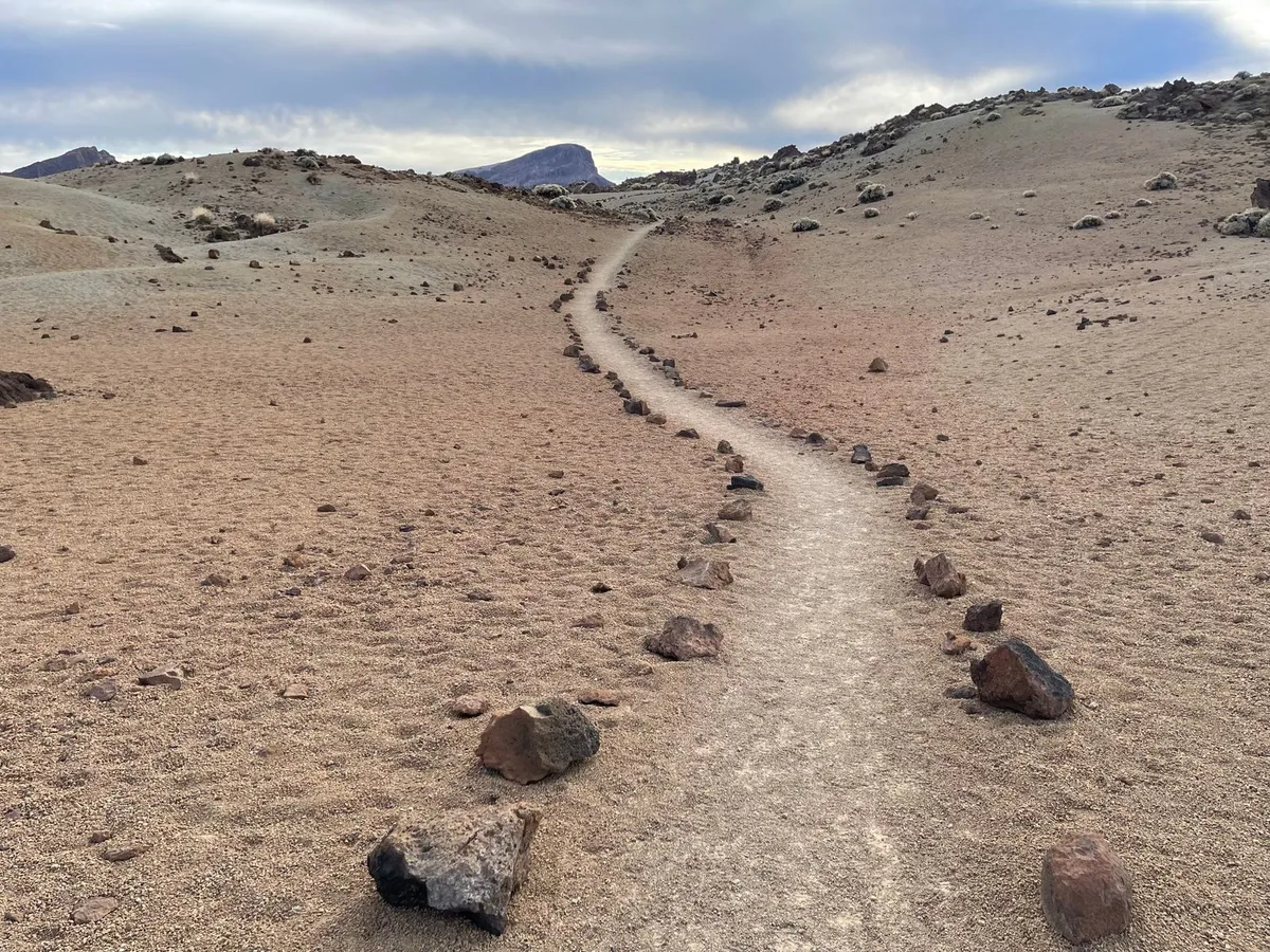
Most stale guides still call this permit free. It is not, and that gap matters when you are budgeting a family. The permit is separate from your cable-car ticket, and daily numbers are limited, so it must be booked in advance through the official platform.
The purist route skips the cable car entirely: Montaña Blanca (PNT-07) climbs 8.3 km to La Rambleta over four to five hours, at €6 on a weekday or €10 at the weekend for non-residents. It is genuinely very hard at altitude. Read the Teide National Park guide and the Mount Teide cable car page before you choose which way up, and the Teide stargazing page if you are staying past dusk.
The €15 fee, the ID checks and the limited timed slots are exactly why many walkers hand the paperwork to a guide who holds the permits and the transport.
Teno
Hiking in Teno, including Masca
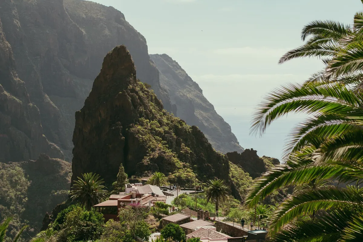
Teno is the wild west of the island, all sheer barrancos and single-track roads. The famous one is Masca, and you need to understand the logistics before the scenery.
The Masca gorge descent is a 5 km one-way drop through a slot canyon to a hidden beach. Access is controlled: you book a timed slot at caminobarrancodemasca.com for €40.66 an adult or €20.33 a child, you reach the village on the mandatory 355 shuttle from the Santiago del Teide cemetery car park (every 20 minutes, 07:00 to 14:00), and staff check for proper walking boots at the gate, so trainers get turned away. Because the trail only goes down, you leave by a mandatory boat pickup at the bottom, priced on top. The headline fee is not the real cost. Budget for the shuttle and the boat too.
Prefer to avoid the turnstile entirely? Two Teno routes need no permit. The Santiago del Teide to Masca ridge walk is a 9.2 km, four-hour crossing with the 355 handling your return. For raw coastline, Camino del Risco runs 10.1 km to the Punta de Teno lighthouse, reached on line 369 from Buenavista del Norte, where private cars are banned outright.
The shuttle, the timed entry, the €40.66 access and the boat exit add up to real coordination. Booking Masca as a guided descent folds all of it into one price.
South & west
Beyond the big three: south and west
Two trails sit outside the Anaga–Teide–Teno spine and both are worth a slot.
Barranco del Infierno above Adeje, one of the standout things to do around the southern resorts, is the south's only serious gorge walk, a 6.5 km round trip of three and a half hours. Entry is €15 for non-residents through barrancodelinfierno.es, capped at 300 walkers a day, and a helmet is compulsory for the rockfall zones. Book the Barranco del Infierno permit hike ahead, and set expectations: the waterfall at the far end is often a thin trickle rather than the torrent the photos suggest. The canyon walls, not the finale, are the reason to go.
Chinyero is the one nearly every list files in the wrong place. It is not in Teide National Park. The 6.4 km PR-TF 43 loop circles the 1909 lava field, the site of Tenerife's last eruption, inside the Corona Forestal and the Chinyero Special Nature Reserve on the west flank. It is easy, needs no permit, and passes through pine that gives way to black cinder. There is almost no shade on the lava, so carry water and start early in summer.
Car-free
Hiking without a car
This is the question the guidebooks skip, and it has a real answer: most flagship trails are reachable on the TITSA bus network. Eight of the ten in the matrix above start from, or near, a stop.
The key lines are worth memorising. Line 355 is the mandatory Masca shuttle from Santiago del Teide. Lines 342 and 348 serve the Teide cable-car base and the Montaña Blanca trailhead. Lines 945 and 947 run into Anaga for Taganana, Chamorga and the El Pijaral approach. Line 369 is the only legal way into Punta de Teno, since private cars are banned on that road.
Two trails resist the car-free plan. The Chinyero TF-38 trailhead is car or taxi only, though you can start lower from Santiago del Teide on foot. Barranco del Infierno has no trailhead bus at all, so you take a local line to Adeje town and walk the last uphill stretch. For route planning and ticketing, getting around by TITSA bus is cheaper than a hire car if hiking is your main plan.
Where to stay
Where to base yourself for hiking
Where you sleep decides how much of your day disappears into driving. Pick the base that matches the massif you came for.
Anaga and the north
Puerto de la Cruz & La Orotava
The pivot for the laurel forest — a genteel colonial garden town with living Canarian culture and easy reach of both Anaga and Teide's northern approach.
The Teide summit
Vilaflor
The highest village on the island, a pine-scented altitude escape where the tour buses skip the stop, and you wake up already halfway up the mountain.
Teno and Masca
Santiago del Teide & Buenavista del Norte
A rugged west-coast frontier town with goat-cheese energy and the 355 shuttle on the doorstep.
Here is the honest trade-off. The big hotel stock and the fastest airport transfers sit in the south, furthest from the best hiking. If you are mixing trails with a beach base and a hire car, Costa Adeje works, and the luxury hotels in Costa Adeje are the strongest end of that market. Line up your airport transfer first so day one is not wasted.
Good to know
Frequently asked questions
Is Tenerife good for hiking?
Yes, and it is one of the few European destinations where you can hike comfortably year-round. Three distinct landscapes sit within a two-hour drive of each other: the misty laurel forest of Anaga, the volcanic high desert of Teide, and the deep gorges of Teno. The main planning point is the 2026 permit and fee system, which now applies to the Teide summit, Masca and Barranco del Infierno.
How hard is it to hike Mount Teide?
The final summit path, Telesforo Bravo, is short at 0.6 km but very hard because of the altitude above 3,500 m, and it needs a permit that costs €15 for non-residents since January 2026. Walking up from the base via Montaña Blanca is a serious 8.3 km ascent of four to five hours that most people find genuinely tough. Many walkers take the cable car up and only hike the summit cone.
Where is the best place to stay in Tenerife for hiking?
It depends which massif you are targeting. Puerto de la Cruz and La Orotava suit Anaga and the northern Teide approach, Vilaflor puts you closest to the summit at altitude, and Santiago del Teide or Buenavista del Norte are best for Teno and Masca. The southern resorts have the most hotels but are the furthest drive from the best trails.
Related on TenerifeTourism
Sources for this guide: TITSA (bus lines, times and fares), the Teide National Park permit system on the Tenerife ON platform (Telesforo Bravo and Montaña Blanca fees and quotas), the official Masca (caminobarrancodemasca.com) and Barranco del Infierno (barrancodelinfierno.es) booking systems, and Cabildo de Tenerife park regulations for Anaga free-access, plus Tenerife ON (tenerifeon.es) for the El Pijaral reservation window and cap. Fees, permits and bus routes verified July 2026.
Field notes are compiled from 2026 hiker trip reports on r/VisitingTenerife — a Montaña Blanca summit report and a permits-and-footwear thread — synthesised and cross-checked against the official rules above. Reviewed July 2026.
About our research
TenerifeTourism.com is an independent travel research hub. Our editorial team compiles each guide from official sources — the TITSA transport authority, the Canary Islands tourism board, and hotel operators' own data — and we flag clearly when a detail is confirmed versus estimated. Read our full methodology.